
Betws y Coed Walk
December 6th, 2019
Today, we’re heading to the beautiful Conwy Valley and the popular town of Betws-y-Coed. The River Conwy runs right through the town and is joined here by two other rivers – the Lledr and the Llugwy.
The River Conwy rises in the marshy, moorland slopes of Migneint, high above the Ffestiniog Valley, from the largest lake in the area, Llyn Conwy. The river then flows north for almost thirty miles, through Betws-y-Coed, Llanrwst and Dolgarrog before it spills its contents into the sea at Conwy.
Over thousands of years, the persistent power of the river has carved through the stones and rocks of Snowdonia to hollow out the wide Conwy Valley. The entire area is rich in wildlife and history, with evidence of human occupation dating as far back as the Stone Age, some 4 or 5,000 years ago. The Romans marched here during their invasion of Britain, and stayed here until about 400AD, and two of the oldest churches in Wales are found in this beautiful valley – at Llangelynnin (12th century) and Llanrhychwyn (11th century).

Today, the Conwy Valley is considered to be one of the most beautiful in north Wales, with its rambling rivers, acres of forest and far-reaching views across Snowdonia and beyond. But, don’t take our word for it. Why not try our Betws y Coed walk today?
This lovely walk takes in the River Llugwy and the River Conwy at Betws y Coed.
Where: Betws-y-Coed, Conwy
Distance: Approx 5 miles
Difficulty: Easy
Start: Car park on Station Road behind the TIC (From the town centre, follow signs for the station or the Motor Museum). Postcode for sat nav is LL24 0AH (approx).
Grid Ref: SH 794 565
Maps: OS Explorer OL17: Snowdon
Directions
1: Walk to the front of the Tourist Information Centre (turn left just beyond the first parking area on the left on Station Road). Turn right and through gate with “Private Road” sign. Walk along path passing Motor Museum then farm and walk under railway bridge.
2: Continue along path to golf course and at fork in path where rivers meet, bear right to follow the river Conwy. Continue until path starts to veer away from river and down short bank. Pass the stepping stones and continue along the river path.
3: Eventually, walk through gate to leave golf course to lane, then bear left for path to St Michael’s Church. Walk through church yard then cross suspension bridge over river and follow footpath across fields then farm to meet road. Turn right and walk along roadside to reach Waterloo bridge.
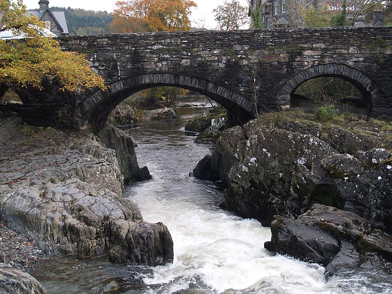
4: Turn right over bridge and follow past petrol station to village centre. Continue through village, pass the Royal Oak Hotel to reach next bridge on right – Pont y Pair (Cauldron Bridge). Cross bridge and turn left for car park then almost immediately left again for path beside river.
5: Turn right to walk beside river and follow path to next bridge (Miner’s Bridge). Either cross it to main road and turn left to walk back to village, or re-trace your steps along river back to Pont y Pair and through village, turning left opposite the Royal Oak Hotel to reach TIC and car park.
Points of Interest
1:The River Llugwy meets the River Conwy at Betws-y-Coed. The River Conwy rises on the moorland of Migneint in central Snowdonia and runs for 27 miles to the Conwy estuary.
2: Betws-y-Coed is famed for its numerous bridges, the most famous of which is perhaps Telford’s Waterloo bridge; built in 1815 to carry the A5 over the River Conwy
**These directions are for guidance only. The Oakeley Arms can accept no responsibility for any loss, damage or injury resulting from the use of this information. The information quoted is correct at the time of writing. Always take a map with you and be prepared for the weather for turn. Do not venture out in bad weather.